Rongai Route is the only route that approached the summit from the north, close to the border of Kenya. It receives fairly fewer climbers and a better choice in case you hike during the wet season since the northern part of the mountain receives the least amount of rainfall. On a negative side, the views are not as breathtaking as on the other routes, and the descent takes you along the crowded route of Marangu. It can be completed in six (6) to seven (7) days
7 days Mount Kilimanjaro Climb Shira Route – Itinerary
Transfer from the Rongai Gate to Rongai Cave
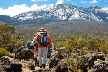
This is the first day of the Mount Kilimanjaro Trek along the Rongai Route. You will transfer from Moshi town by car to Marangu gate where you will clear all the park entrance formalities before heading to the trail head at Rongai Gate. You will later follow the winding route as it takes you through fields of corn and potatoes before you begin ascending in the verdant forest the is habitat to various wildlife such as the black & White Colobus Monkeys.
Route Plan: Rongai Gate to Rongai Cave
Elevation: 6,398 feet to 9,300 feet
Distance: 8 kilometers / 5 miles
Hiking Time: 3 to 4 hours
Habitat Moved: Rain Forest
7 days Rongai Route; Trek from Rongai Cave to Second Cave to Kikelewa Cave.
Today morning, you will steadily ascend to the higher second Cave. From there you will proceed through the moorland, going off the main trail to a smaller trail heading towards the Mawenzi peak just before you reach the Kikelewa cave where you will spend the night.
Route Plan: Rongai Cave to Second Cave to Kikelewa Cave
Elevation: 9,300 feet to 11,300 feet (and further ascent from 11,300 feet to 11,811 feet)
Distance: 6 kilometers / 4 miles (and additional 6 kilometers / 4 miles)
Hiking Time: (and an additional 3 to 4 hours)
Habitat: Heath.
Shira Route; Climb from Kikelewa Cave to Mawenzi Tarn
You will have a have a short day during which you will ascend high the verdant slope where you will enjoy some amazing views of the neighboring terrain. As you hike away from the moorland zone and enter into the Alphine Desert zone whose terrain changes very drastically. Tonight’s accommodation will be at the Mawenzi Tarn found below the rocky peak of Mawenzi. The rest of the day may be spent exploring this area.
Route Plan: Kikelewa Cave to Mawenzi Tarn
Elevation: 11,811 feet to 14,160 feet
Distance: 5 kilometers / 3 miles
Hiking Time: 3 to 4 hours
Habitat Moved: Alpine Desert.
Acclimatization Day; Mawenzi Tarn to Mawenzi Ridge to Mawenzi Tarn
This is an additional day to help climbers acclimatize and it will be spent hiking on the Mawenzi ridge. The terrain in this area offers views of the Mawenzi peak as well as the Kibo peak. Later, you will return and camp at the Mawenzi Tarn
Route Plan: Mawenzi Tarn to Mawenzi Ridge to Mawenzi Tarn
Elevation: 14,160 feet to 14,400 feet to 14,160 feet
Distance: 2 Kilometers / 1 mile ascent (and 2 Kilometers / 1 mile descent)
Hiking Time: 1 to 2 hours ascent (and 1 to 2 hours descent)
Habitat: Alpine Desert.
7 Days Rongai Route; Hike from the Mawenzi Tarn to Kibo Hut
You will ascend before crossing the ‘saddle’ – a lunar desert found between the peaks of kibo and Mawenzi. You will proceed to Kibo Hut found at the bottom of the Kibo Crater where you will camp for dinner and rest before the summit day.
Route Plan: Mawenzi Tarn to Kibo Hut
Elevation: 14,160 feet to 15,430 feet
Distance: 8 kilometers / 5 miles
Hiking Time: 5 to 6 hours
Habitat: Alpine Desert.
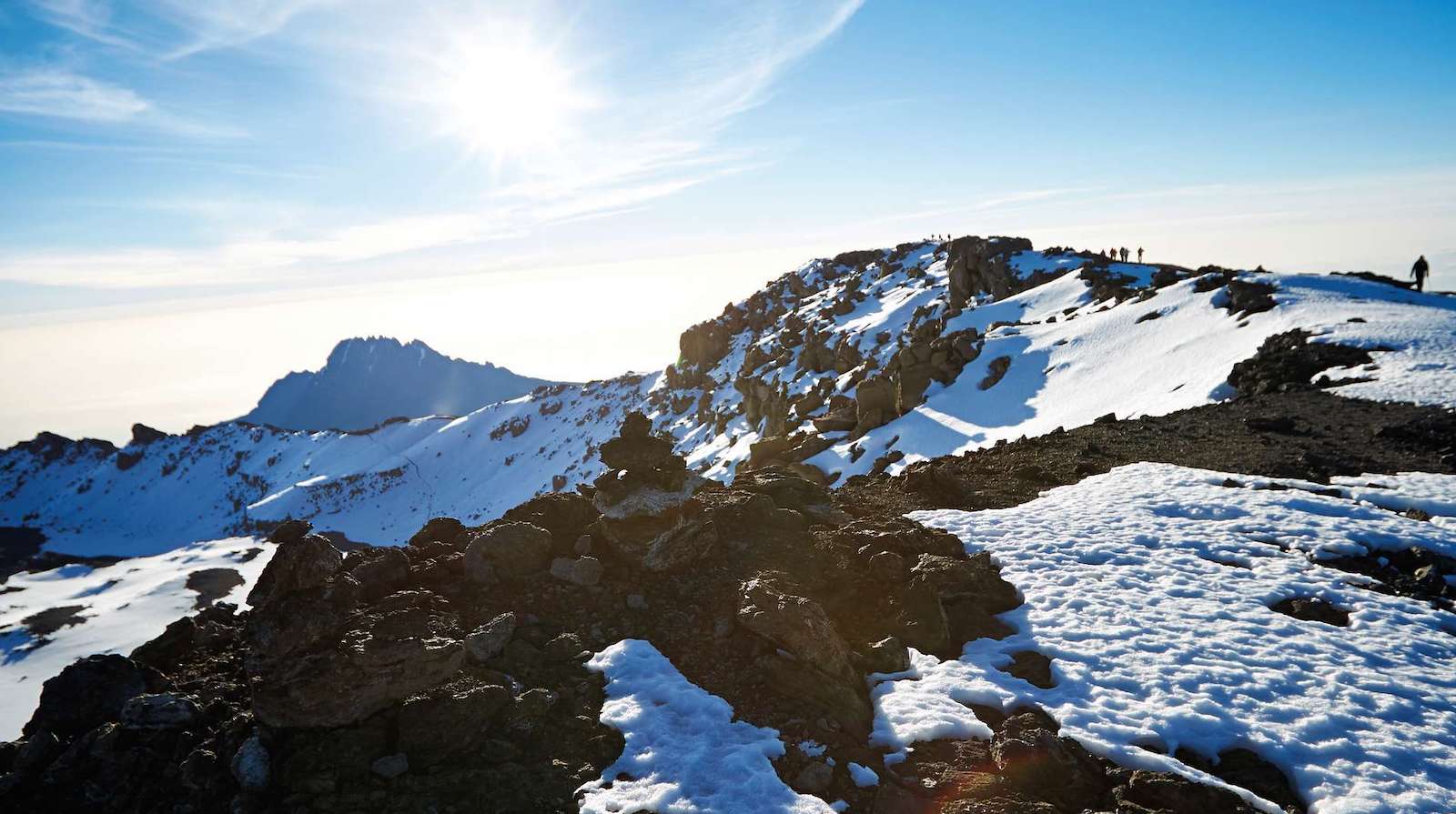
Summit Day!; from Kibo Hut to the Uhuru Peak to Horombo Hut
This is the summit Day. You will begin this day’s hike to the summit very early between midnight and 2:00am. You will hike and head North West and ascend across the thick gravel in the dark as you take short breaks until you reach Gilman’s point at an elevation of 18,600 feet found on the rim of the crater. This section of the trail is the most challenging both physically and mentally.
There you will have a brief rest and if the weather is good, you will be able to see the most breathtaking sunrise. From this point you will ascend for about an hour traversing the snow covered terrain all the way to the Uhuru peak. The Uhuru summit which stands at a height of 19,341 feet (5,895 meters) is the highest point on Mountain Kilimanjaro and the African continent at large.
After spending some time at the summit resting and taking some photographs, you will begin the descent to Horombo Hut where you will have your evening meal before having your night’s rest.
Route Plan: Kibo Hut to Uhuru Peak to Horombo Hut
Elevation: 15,430 feet to 19,341 feet ascent (and 19,341 feet to 12,250 feet descent)
Distance: 6 kilometers / 4 miles ascent (and 16 kilometers / 10 miles descent)
Hiking Time: 6 to 8 hours ascent (and 4 to 5 hours)
Habitat: Arctic / moorland.
Hike from Horombo Hut to Marangu Gate
This is the final day of the seven days; hike on Mt. Kilimanjaro along the Rongai Route. You will make a long descent through the tropical rain forest up to the Maranga gate headquarters where you will receive your summiting certificates. Your driver will meet you there and drive you back to your hotel in Moshi Town
Route Plan: Horombo Hut to Marangu Gate
Elevation: 12,205 feet to 6,046 feet
Distance: 20 kilometers / 12 miles
Hiking Time: 5 to 7 hours
Habitat: Rain Forest.
7 Days Kilimanjaro Climb Rongai Route – Prices
Contact our Safari and Mount Kilimanjaro experts for the most updated prices and claim your discount.
Tour Reviews
There are no reviews yet.
Leave a Review